Tuvvy

Activity

A Strava-style GPS tracker: record rides, runs and walks with live distance, speed and a route drawn on an OpenStreetMap map — plus a route planner with cycling directions.

9:41▲ ◢ ▮
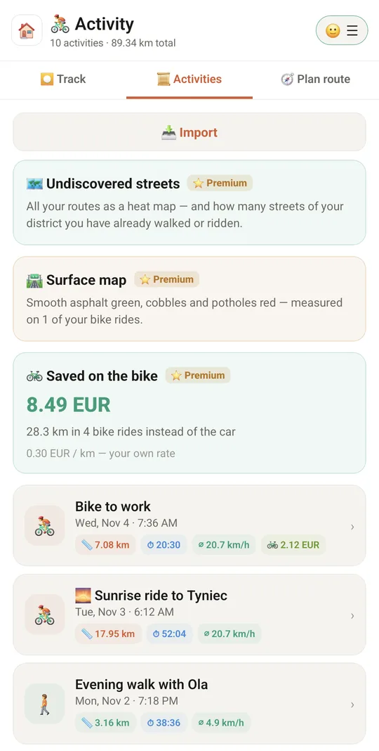
Every ride, run and walk
9:41▲ ◢ ▮
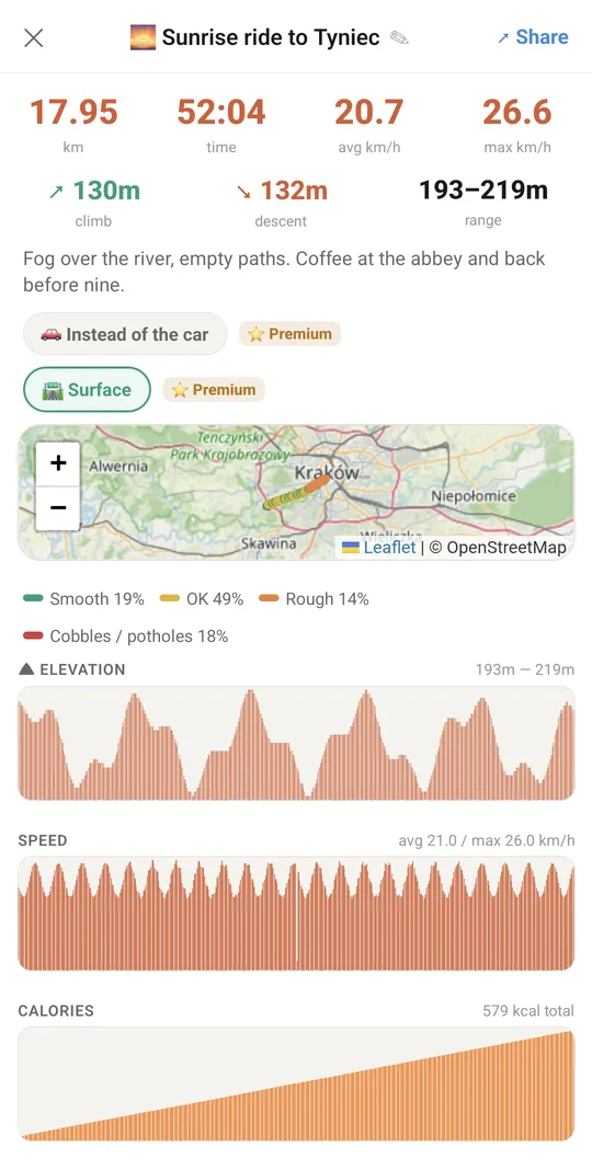
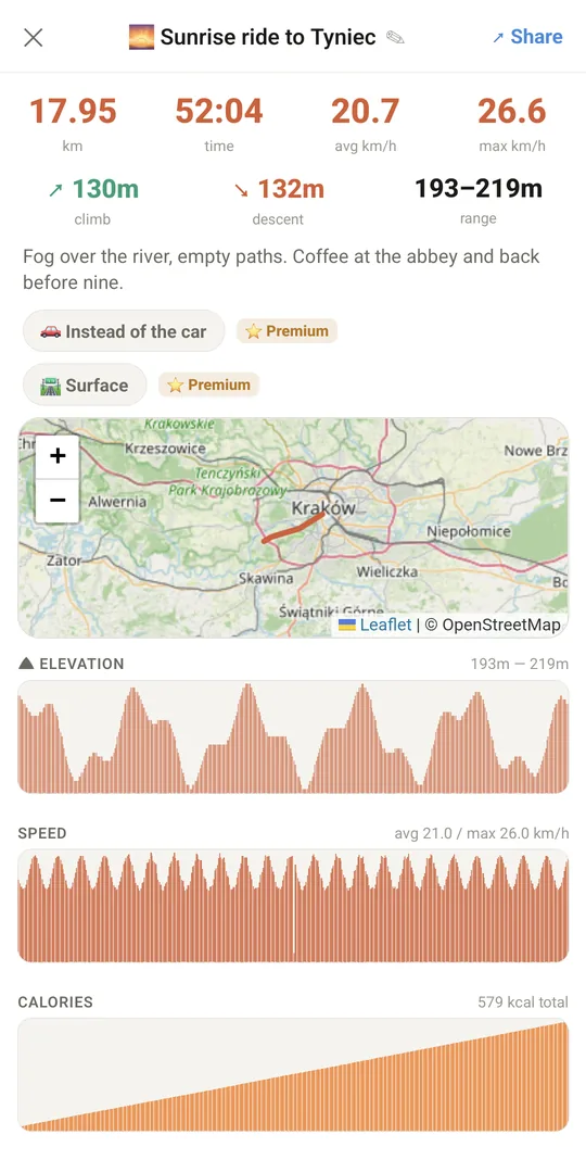
Route on the map with all the numbers
9:41▲ ◢ ▮
Elevation and speed
Elevation and speed
9:41▲ ◢ ▮
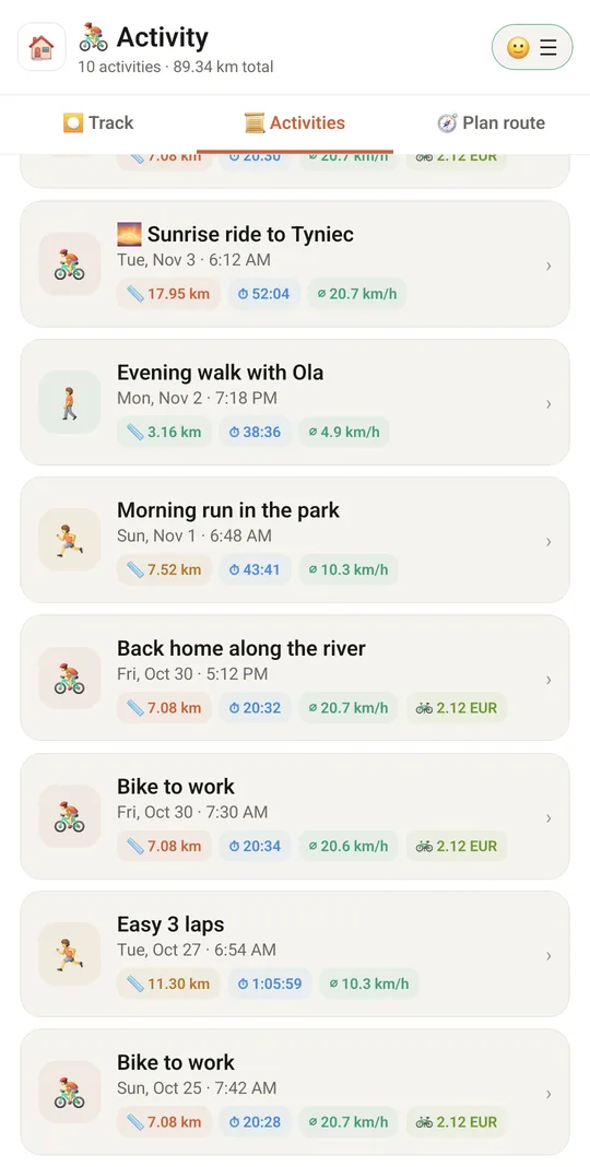
Weeks of activities
Weeks of activities

Already in the app

59 functions, free in every Tuvvy.

Activity recording (GPS)

  • Pick the sport before starting: ride, run, walk
  • START button showing the selected sport
  • Pause and resume recording (time, distance, elevation and speed frozen while paused)
  • STOP button saves the activity with a summary (km, time, average speed)
  • Too-short activities are discarded (not enough movement)
  • Live stats: distance, time, current, average and max speed
  • Live elevation gain (climb in metres)
  • Live calorie counter (MET for sport and speed plus your weight)
  • Long-press the kcal counter to edit your weight
  • Clock with the current time visible while recording
  • Live charts: elevation, speed, cumulative calories
  • Background recording with the screen off (foreground service with a “Tuvvy Activity” notification)
  • Recording continues after leaving the module screen
  • Warning when the phone records without a background service (keep Tuvvy on screen)
  • Location service auto-repaired when you return to the app
  • Screen stays on while recording (keep-awake) in no-background mode
  • Recover an unfinished activity after the app closes: resume, save or discard
  • GPS noise and jump filtering, time counted as moving time
  • Messages when location permission is missing

Map

  • OpenStreetMap (Leaflet) map with your current position on opening
  • Live route drawing with a position marker
  • Full-screen map with a STOP button
  • Map returns to your current position after recording ends
  • Ride a saved route: dashed route on the map, guidance while recording

Route planning

  • “Plan route” tab with address search (Nominatim)
  • Start point from GPS when the “From” field is empty
  • Route modes: walking, cycling, scooter (road route), car
  • Route calculation (OSRM) with distance and time on the map
  • Save a route under your own name
  • Saved routes list: tap = show, ▶ = ride this route, long-press = delete

Activity history

  • “Activities” tab listing saved activities
  • Header with activity count and total kilometres
  • Activity card with distance and average speed
  • Details: route map, km, time, average and max speed
  • Details: ascent, descent, elevation range
  • Detail charts: elevation, speed, calories
  • Edit an activity: name, sport, notes (calories recalculated when the sport changes)
  • Delete an activity with a long-press
  • Data per Tuvvy account (AccountChip)
  • 🚦 Stops on the way: how many times you stood at traffic lights, other short stops and breaks, with the time of each and how much of the ride you stood still

Import and export

  • Import GPX, TCX, FIT files (also zipped .gz)
  • Import a whole Strava export ZIP (names and types from activities.csv)
  • Import many files at once with a progress bar
  • Import preview with sport change (tap the icon)
  • Duplicates marked as “Already imported”
  • Route files without timestamps imported as saved routes
  • Counter of skipped files (no GPS or unreadable)
  • Export all activities as a ZIP of GPX files
  • Export a single activity to a GPX file (Strava, Garmin, Komoot)

Sharing

  • Share as text (stats + GPS + short link)
  • Share as an image (map snapshot, ready for Instagram)
  • Copy a tuvvy.app/r/… link that opens the route on a map
  • “Hide start and finish” option (trims the first and last metres in text, link and GPX)
  • Live sharing on my wall (on/off)
  • Send a live activity card to a chat
  • Wall broadcast closes with a summary when finished

Menu and settings

  • ☰ bottom menu: Import, Export, Weight, Tuvvy accounts, Help, Language
  • User weight for calorie counting (20–400 kg, per account)
  • Activities and routes included in the Tuvvy backup

With Tuvvy Premium Premium

Extras that tie this module to the rest of your Tuvvy.

⭐ Premium

Ghost on the route

ride or run a route you did before and the banner shows live how many seconds you are ahead of or behind your earlier ride — from any point on the route. Tap the banner to race another ride; 👻 on the map turns it off

⭐ Premium

While you record, Tuvvy checks the rain forecast and sunset, works out how long the way back to your start takes at your pace and tells you when to turn back to get home dry or in daylight — on screen and as a notification

⭐ Premium

🚗 The same route by car

a planned route shows what the trip would cost by car, at your car’s real cost per km from Fleet

⭐ Premium

Saved on the bike

a bike ride marked “🚗 Instead of the car” counts in money at your car’s real cost per km from Fleet (or your own rate); the total is on a card in 📜 Activities and can count toward the Wealth goal

⭐ Premium

After dark

after sunset the family you choose sees your route live until you stop recording, then gets “✅ safe”

⭐ Premium

Wind card after planning a route

wind speed and direction and how much of the route is into a headwind

⭐ Premium

Reverse the route so the headwind comes first, while you are fresh (ignored under 8 km/h)

⭐ Premium

Heat map of all your routes

the more often you ride a street, the darker it gets

⭐ Premium

Your district’s streets from OpenStreetMap and the % explored: a street counts at 80% of its length

⭐ Premium

Colours

ridden today, last 7 days, ticked off, in progress, to discover — hide any layer, change colours and line width

⭐ Premium

Closest streets to discover; ticked-off streets are saved with your account and come back after you log in

⭐ Premium

While you record a bike ride, the phone’s motion sensor feels how hard the bike shakes and rates every ~30 m: smooth asphalt green, OK yellow, rough orange, cobbles and potholes red

⭐ Premium

The rating takes your speed into account and is compared with the rest of the same ride, so a phone in the pocket and one on the handlebar give the same colours; stops, walks and runs are left out

⭐ Premium

🛣 Surface layer on the map of a recorded ride, with how much of the ride was on each kind of surface, and one map of all your rides (the newest ride wins where routes overlap)

⭐ Premium

🛣 Avoid bad surface in the bike planner

picks a route around the stretches you measured as rough and shows the cost, e.g. “+400 m, no rough stretches”

⭐ Premium

Keep the phone on the handlebar with the screen on — with the screen off Android stops the motion sensor and those stretches get no colour; a reversed planned route also avoids bad surface

⭐ Premium

🌍 Everyone

a surface map of the whole city from the rides other people chose to share — an average for every ~20 m, shown once at least two people have ridden there

⭐ Premium

Share my measurements anonymously (off by default)

only ~20 m map squares and how rough they are — no dates or times, nothing from the first and last 200 m of a ride

⭐ Premium

The planner also avoids bad surface measured by others, and the 🛼 Skates and 🛹 Skateboard modes accept a much longer detour to keep off rough stretches

Coming next

Ideas we are working on or considering — tell us which one you want first.

Idea

Errands loop

The planner builds one loop through the school, the parcel locker and the shop from your Shopping List.

Idea

Scenic loop

A route of the distance you choose that passes viewpoints and places from Must-See Places.

Idea · Premium

Race pace plan

Enter a race and target time: you get a pace for every kilometre, hills included, and a voice that keeps you on plan.